What Is Space Domain Awareness — And Why "Seeing" a Satellite Isn't Enough Anymore
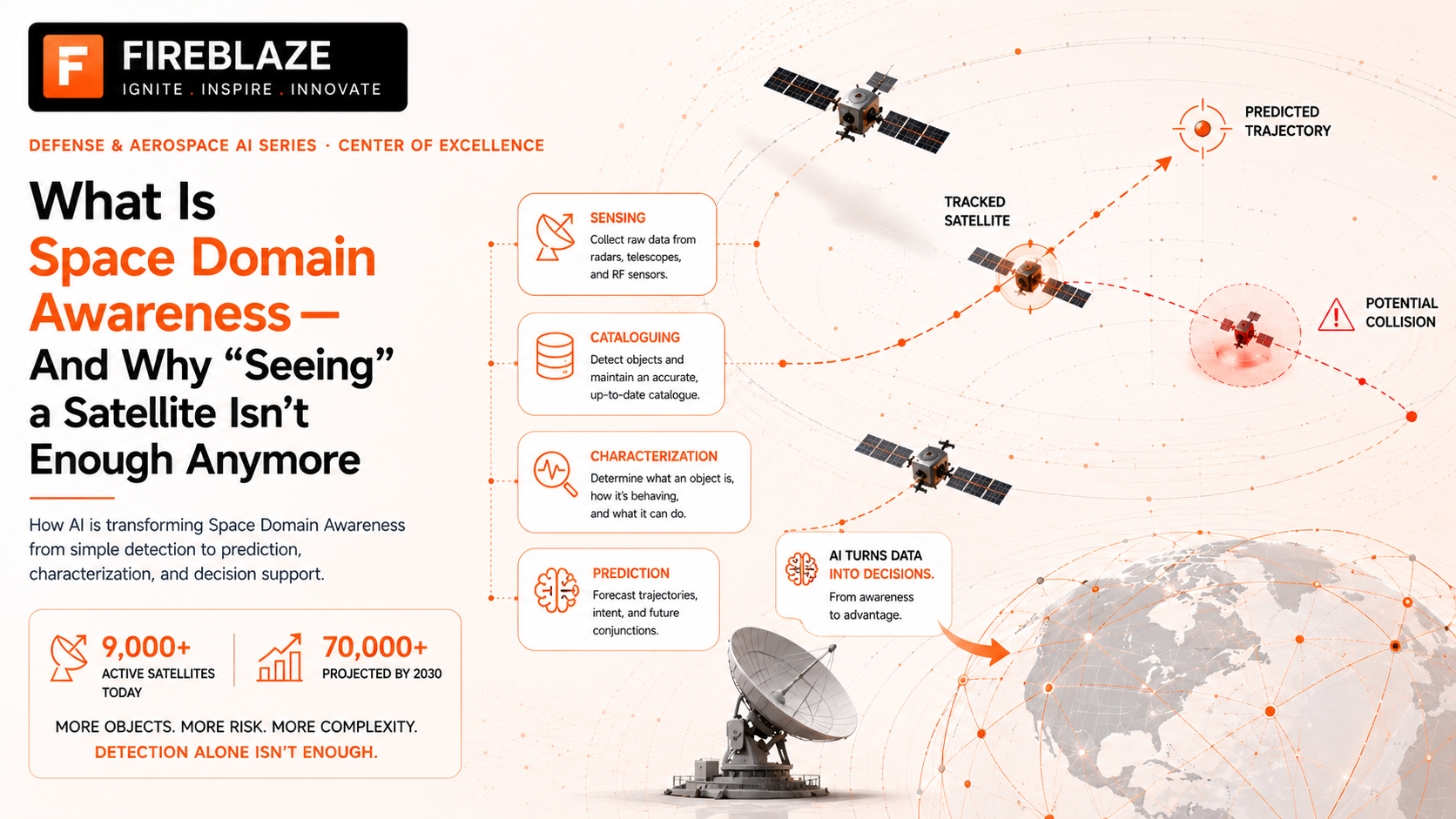
For most of space history, knowing a satellite existed and roughly where it was counted as success. That bar has quietly moved. In 2026, simply "seeing" an object in orbit is treated as the easy part — the real work, and the real money, is in understanding what it's doing and what it's about to do next.
1. What is Space Domain Awareness, in plain terms?
Space Domain Awareness (SDA) — sometimes called Space Situational Awareness (SSA) — is the practice of continuously knowing what's happening in orbit: what objects are up there, where they are, how they're moving, and whether any of that movement matters. It combines physical sensors (telescopes, radar), historical records, and increasingly AI-driven analysis to build what the industry calls a "common operating picture" of space.
Think of it as air traffic control, but for everything orbiting the Earth — except unlike a runway, there's no single authority directing traffic, no universal rulebook everyone follows, and the "airport" is a thin shell around the entire planet with tens of thousands of independent, uncoordinated objects moving through it at roughly 17,000 miles per hour.
2. The old way: just knowing something is there
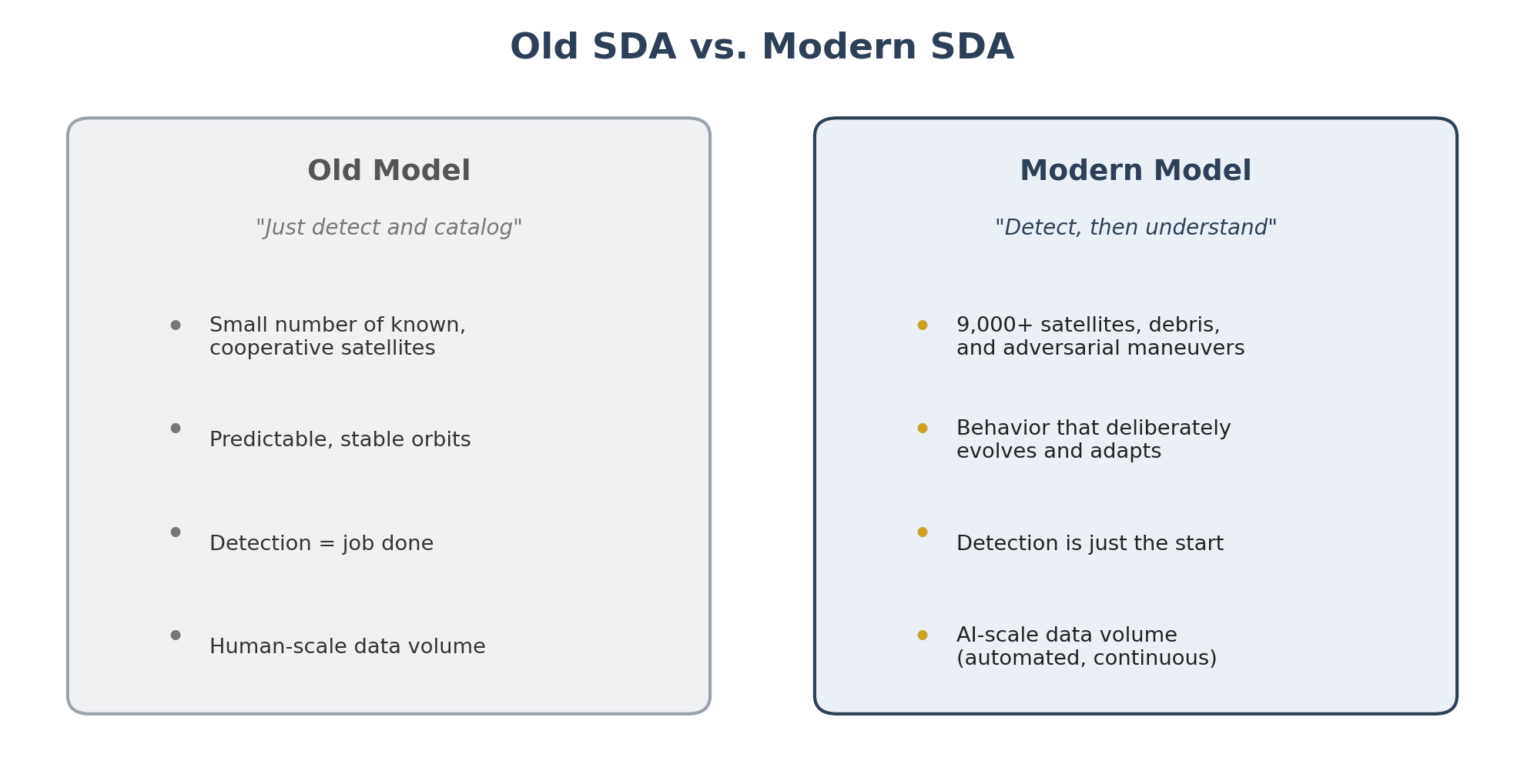
For decades, SDA mostly meant object detection and cataloguing — a relatively short list of government-owned satellites, tracked by government-owned sensors, moving along well-documented, predictable paths. If you knew an object existed and could estimate its position, you'd done your job. Military and civil tracking networks built entire systems around this single task: detect, catalog, repeat.
This worked fine when orbit was sparsely populated and mostly cooperative — satellites belonged to a handful of nations, followed known orbits, and rarely did anything unexpected. Detection alone was a reasonable stopping point because there wasn't much more to figure out.
3. Why "seeing" stopped being enough
Three things broke that old model, more or less at the same time.
First, volume. Low Earth orbit now holds more than 9,000 active satellites, with forecasts projecting that number could exceed 70,000 by 2030 as commercial mega-constellations continue expanding — alongside an estimated 1.2 million-plus untracked debris fragments large enough to destroy a satellite on impact. At that scale, "detect and catalog" stops being a finish line and becomes a constant, overwhelming stream of raw data with no built-in way to tell what actually matters.
Second, behavior got harder to predict. Object detection assumes a satellite mostly stays on a known, stable path. That assumption breaks down when satellites are specifically designed to maneuver — for station-keeping, for servicing other satellites, or, in the case of near-peer military competitors, for tactics that deliberately evolve mid-engagement rather than following a fixed pattern. Knowing where an object was five minutes ago tells you very little if it can change course in ways a static catalog was never built to anticipate.
Third, intent became the real question. A satellite quietly maneuvering closer to another country's asset could be routine, or it could be a deliberate provocation — and simple position tracking can't tell the difference. Distinguishing between the two requires understanding behavior over time, not just a single snapshot of location. This is precisely the shift covered elsewhere in this series through tools like Slingshot Aerospace's TALOS and LeoLabs' Delta: both were built specifically because passive detection no longer answers the questions operators actually need answered.
4. What modern SDA actually involves
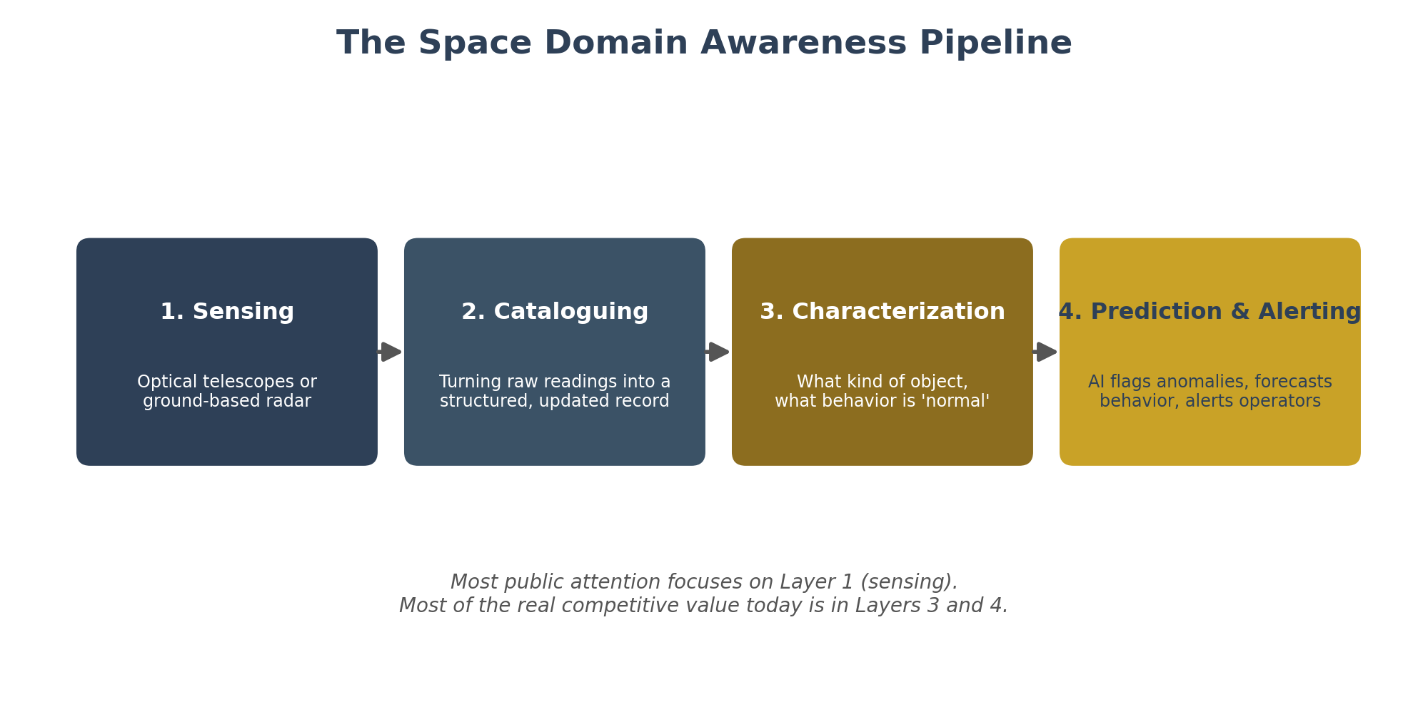
Today's SDA is best understood as a layered pipeline, where each layer builds on the one before it:
Sensing — the raw physical layer, using either ground-based optical telescopes (which need clear skies and, depending on the system, some sunlight) or ground-based radar (which works day and night, through cloud cover, but is generally more expensive to build and operate at scale).
Cataloguing — turning raw sensor readings into a structured, continuously updated record of what object is where, cross-referenced against historical launch and object databases.
Characterization — determining not just where an object is, but what kind of object it is, what it's likely capable of, and whether its recent behavior fits a known, expected pattern or looks unusual.
Prediction and alerting — the newest and most AI-dependent layer, where systems flag anomalies, forecast likely future behavior, and translate all of that into something a human operator can actually act on quickly, rather than raw data they'd have to interpret manually.
Most of the public conversation around SDA still focuses on the first layer — how many sensors, how many objects tracked — because it's the easiest number to headline. But the competitive and military value has clearly shifted toward the last two layers: characterization and prediction, not raw sensing capacity alone.
5. Who needs this, and why it's suddenly urgent
Three groups depend on good SDA, each for slightly different reasons. Commercial satellite operators need it to avoid collisions and comply with tightening regulations — the FCC, for instance, now requires LEO satellites to be deorbited within five years of the end of their mission, down from a previous 25-year guideline, which requires accurate, ongoing tracking to demonstrate compliance. Civil and scientific agencies need it to protect shared infrastructure like GPS and weather satellites that everyone quietly depends on. And military space commands need it for an obvious reason: an adversary's satellite behavior can be an early warning sign of much bigger geopolitical moves, and missing that signal has real strategic consequences.
The urgency in 2026 specifically comes from the volume problem catching up with everyone at once — commercial constellations, debris accumulation, and rival military space activity are all accelerating on overlapping timelines, which is why SDA has gone from a specialized government function to a genuine, fast-growing commercial market, estimated at somewhere between roughly $1.7 billion and $2.3 billion in 2026 depending on the research firm consulted.
6. Why this matters going into the rest of 2026
The core lesson underneath all of this is a simple reframing: SDA is no longer a sensing problem, it's an understanding problem. Building more telescopes or more radar sites still matters, but it's table stakes, not a differentiator — every serious player in this space is converging on the same conclusion, whichever sensor technology they started with. The real competition, and the real AI investment, is happening in the characterization and prediction layers: turning a flood of raw tracking data into a clear, trustworthy answer to the question that actually matters — not "what's up there," but "what is it about to do."
That distinction — detection versus understanding — is the thread connecting almost everything else in this series, from specific companies to specific technologies to the broader market forces pushing all of it forward.
Sources: This piece explains general, publicly known concepts in space domain awareness, with factual references to companies and figures (Slingshot Aerospace, LeoLabs, FCC orbital debris rules, satellite population forecasts) covered in more depth elsewhere in this series. Market size and satellite population figures are drawn from published industry research and are presented as estimates, consistent with sourcing elsewhere in this series.